Best Island
Beautiful Island
Beautiful Beach
Showing posts with label mountain. Show all posts

Tuesday, January 25, 2011

Tropical Heaven; Taman Raya Bung Hatta

The park is not far from Padang, the capital of West Sumatera, Indonesia. It is about 15 kilometer via Solok route. The park was popular with "Taman Raya Bung Hatta", Taman Raya mean The great park, Bung Hatta is one of Indonesian proclamator. This park is the nature park which equipped by various of the rare flora and the exotic flowers.

Taman Raya Bung Hatta is about 70.000 Ha in area, with lightweight wavy landscape configuration, rather steep and hilly over 200 meter over the sea level.This park is also known as "Tropical Heaven"where often become roaming field and wildlife observation. The park is part of Kerinci National Park. In the park there are 352 type of flora and 170 type of fauna that be protected.At long time ago, Taman Raya Bung Hatta was known as Setya Mulya Botanic Garden. If you walk around the park, you will see any species of flora that maybe can not found at anywhere. For example, the flower Rafflesia Arnoldi. It is the largest flower or popular with "the giant flower". Beside that , the flower is popular with the rotten smell, therefore Indonesia people use to call it "the carcass flower".

The largest flower was named as same as the first founder, Sir Thomas Stamford Raffles Lieutenant Governor of the British Government,and botanist Joseph Arnold, exactly they found this flower at Bukit Barisan mountain slopes.

The flower of Rafflesia Arnoldi is a miracle of rare. This flower need the time to grow until 10 month and it just bloom about 15 days. While the flower is blooming, it usually has a diameter of one meter.

If you want to see the Rafflesia Arnoldi blomm, you can visit between July and September.


Cholula;The Greatest Pyramid In The World

The Great Pyramid of Cholula is a complex of several big temples in the small town called Cholula, in the outside of Mexico. Also known as, "Mexico's Largest Pyramid!". It can be reached by spent 10 minutes from Puebla street.This building was 2000 years old and at first it called the great
Pyramid of Tipanipa, exactly it is before Spanish coming in 1519. But over the development period, the pyramid was changed to become The Great Pyramid of Cholula.

The Pyramid is not clear yet, is it funeral or not. But clearly, this buildings is the important side for their culture (for Mexico people whose stayed there) thet need to be saved.

The Great Pyramid of Cholula has a volume space that bigger than the other ancient structure of Pyramid such as The Chichen Itza Pyramid in Mexico and the others in Egypt. Even the Great Pyramid of Cholula is claimed as The Greatest Pyramid in the world.
At first looking, The Pyramid is look like a hill or green hill which stand there a building that seem like a church ( Nuestra Senora de los Remedios). But if you rise over the Pyramid, you will see the original structure of the pyramid which consist of four levels.


From here, you can see El Popocatepetl (the snow mountain which separate among the valleys in Mexico)clearly.
Like the archeology said, The Great Pyramid of Cholula has an important side. From altar, platform, ladder and tunnel which has lenght over 5 kilometer .

The other artifact was found in Cholula is a mural that seemed a real human. The mural is predicted has a lenght 50 meter or 165 foot with a full colors shade.
if you would like to visit it, you must prepare $3.70 for entrance. visit this site to find more picture http://www.delange.org/Cholula2/Cholula2.htm

Saturday, November 27, 2010

The Road Of Death

I think i will not say anything after i knew about this dangerous and most dangerous road in the world. Exactly, it runs in the Bolivian Andes, 70 km from La Paz to Coroico, and plungs down almost 3,600 metres in an orgy of extremely narrow hairpin bends and 800 metress a gaping chasm which ready to pounce on anything that falls. Every year it is estimated 200 to 300 people die on a stretch of road less than 50 miles long. In one year alone, 25 vehicles plunged off the road and into the ravine. That is one every two weeks. This Journey blog never recommend you to go there, but if you curious you might enough see it from far.

It seems so weird and fear that one of the main roads out of one of the highest cities on Earth should actually climb as it leaves town. Then climb it does sapping 5 kilometres (three miles) above sea level, where even the internal combustion engine is forced to toil and splutter. Then it pauses for a while on the snow-flecked crest of the Andes before pitching - like a giant white knuckle ride - into the abyss.

That dangerous road is starting from Bolivia's main city, La Paz to a region known as the Yungas. The "road of death"-that it's name-was built by Paraguayan prisoners of war back in the 1930s.

Then about the hairpin bends. Perched on hairpin bends over dizzying precipices, crosses and stone cairns mark the places where travellers' prayers went unheeded. Where, for someone - the road ended. But even these stark warnings are all too often ignored. Because of impatient motorist.

When the dry season in Bolivia gone, soon the rains will come cascading down the walls of the chasm and huge waterfalls will drench the road turning it's surface to be slime.

Then will come those heart-stopping moments when wheels skid and brakes fail to grip. There are stories told of truckers too tired - or too afraid - to continue, who pull over for the night, hoping to see out an Andean storm. But they have parked too close to the edge. And as they sleep in their cabs, the road is washed away around them.

But for now the road is a ribbon of dust. Every vehicle passing along it churns up a sandstorm in its wake.

Choking, blinding clouds obscure the way ahead. Around one hairpin, a cloud of debris was beginning to clear.
As it did, it seems people milling around in the road. Passengers from one of the overloaded and decrepit buses which run the gauntlet of this road.

There was nothing anyone could do. Mobile phones do not work here. In any case, who would you call? There are no emergency services. It is so fear. And no way of getting help through, even if any were to be found. The bus driver bled to death.

Thats way the road is named the "Road of Death".


Friday, November 5, 2010

The 72 Peaks of The Song Shan Mountains

Many interesting place can be visited in China beside the great wall, there is the most awesome natural view in Henan province where there is one of the holy mountain of Tao it is Song Shan. The Song Shan has 1512 metres height and consist of 72 mountain peaks, and also there are the Budhist temple, pagoda, and keeper manaret. The most interest in this place are Shaolin temple(The training center of kungfu), and another is Zhongyue Miao(the Tao temple). We can reached the place via cable car from the Luoyang station or Zhengzhou station then stop in Baima Si (the oldest temple in China). It located at 64 kilometres between Luoyang and Zhangzhou.


Dengfeng


The Peaks


The beautifull panorama of these mountains are seen at the slope height that very sharp at over the valley. Moreover, there are many trees surrounding area give the interesting impression. Directly underneath the mountain, lies the quaint little town of Dongfang. Used mainly as a base for travellers hiking up the mountain, it may be a little rough around the edges in terms of prettiness, but nevertheless it is still a place to visit.

The Song Shan is the main mountains of the five big mountains and used to called Zhong Hue(Central Peak) of the holy Tao mountain was named by the king Ping Zhou while he moving the capital to the Luoyang in 771 BC. If coming to Song Shan, then there are more places to visit apart from the Shaolin Temple. Why not take a trip to Songyang Academy (Songyang Shuyuan), located at the foot of Taishi Shan. This is one of the oldest academies in China, and in the courtyard are two cypress trees which are believed to have been growing for 4,500 years! Songyue pagoda (Songyue Ta) is nearby and is one of China’s oldest brick pagodas, dating from the Song Dynasty.

Baima Si Temple


The Shaolin Temple (Shaolin Si) is the legendary birthplace of gongfu (kung fu). Because of its fame, it has become a victim in itself over the years; a target of war, the temple has been ruined, rebuilt, destroyed and rebuilt several times throughout the decades. The last fire was in 1928 and since then has seen restoration ever since, especially with the droves of tourists who visit each year.

At the Shaolin Temple, there is much wushu (athletic Chinese martial arts) instead of true gong fu. True gong fu takes years of intense mental and physical study instead of just physical training. Coming here, you enter the temple just past some of the most wonderful stelae, some are delicate works of art from abroad. You can also see the Pilu Pavilion (Pilu Dian) with its famous depressions in the floor, as well as the Guanyin Hall (Guangyin Dian).


Left of Shaolin Temple is a path that will lead you up to Wuru Peak (Wuru Feng). It gets quite busy up here with tourists, but you can escape them by visiting the cave (DAmo Dong) where the Domo Bodhidharma meditated for nine years. Although the signs say it’s only 500m away, it’s really 3km.


The Shaolin Monastery N Song Shan (4), Luoyang - Songshan, China
This travel blog photo's source is TravelPod page: Song Shan N the Shaolin Kung Fu Monastery
Kungfu Center

Friday, October 29, 2010

God's Window

It's name is God's Window.This is the top of the cliff with a layer of clouds and fog that covered the landscape beneath.God's Window located in the area of tourism in Mpumalanga Province, South Africa (South Africa).God's Window is one of the tourist sights are located not far from the small town of Graskop. It takes about 5-7 hours from Johannesburg to this small town.

There are several tourist attractions located nearby and not far from Graskop. These places are named the Panorama Route. Located alongside the Blyde River Canyon nature reserve. Panorama Route is a region north of the Drakensberg Mountains, which stretch 100 km from Mpumalanga and KwaZulu Natal in South Africa until Lesotho country.

Panorama Route is one of the famous tourist destinations in South Africa. The uniqueness of this place are the plants that live on rocky cliffs remain green when winter arrives. At the same time. the others area is yellowing because of plant withered. God's Window is the most famous place in Panorama Route. The strategic location makes God's Window more visited than two other places adjacent : Pinnacle Rock and Wonder View. Only in God's Window , visitors entrance is 10 rand (about US$1.25). whereas at Pinnacle Rock and Wonder View we do not have to pay.
From God's Window, located at an altitude of 1892 meters above sea level, we can see the Kruger National Park and Mozambique country with distance of 100 kilometres from God's Window. This scene - plus fog and clouds that sometimes blanketed-the reason why this place is called God's Window. For those who want to the summit, it is advisable to be careful, especially when it rains, because the path which must be passed usually slippery.


In Mpumalanga, the local government spoil visitor as well as empowering the local community. It's hard to find poor road access to tourist attractions. Cleanliness is also very guarded. Appeal to maintain cleanliness on display at various places. We're not entirely difficult to find a clean toilet.
God's Window view
No one is disturbing. The traders sell their merchandise in an orderly manner and not forced though sometimes offer the goods with high price. "The money you spend supports the continuity of the life of the traders who are residents around,"an announcement that readeble in God's Window.

Canyon River

Wednesday, October 14, 2009

Tawangmangu, Karanganyar's Plateau

Tawangmangu is a district in Karanganyar regency, Central Java. This place  is renowned as a tourist area because it's has a beautiful view and fresh air.

Tawangmangu known as a tourist attraction on the slopes of the mountains west of Mount Lawu, it can be reached by land vehicles for about an hour from the city of Surakarta (Solo). This place is renowned as a tourist area since the Dutch colonial period .

The main tourist destination object is Grojogan Sewu Waterfall (height 65 m). In this resort there are a variety of tourist supporting facilities such as swimming pools and various forms of lodging. We can climb the top of Mount Lawu from this district. Also, from here there is the pass that led to the Sarangan Lake in Magetan, East Java through Cemorosewu.


Monday, October 12, 2009

BROMO, EAST JAVA

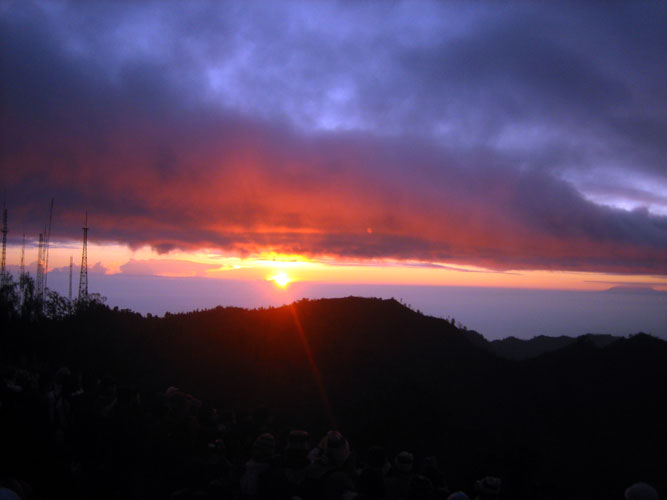
Bromo is one of the tourist destination in East Java. This beautiful site is located in Bromo Tengger Semeru National Park in the eastern city of Malang, East Java. The tourists was not only from local, but the foreign tourists are love to see this wonderful mountain. Bromo has a typical scene and it makes Bromo proper destination.


Tuesday, October 7, 2008

Mount Kelud


On Mount Kelud from Normal to Caution


Mount Kelud (1731 m) in East Java is a volcano that up to now are active. Because of the increased activity of Mount Kelud since 11 September 2007 Center Vulkanologi and Geological Disaster Mitigation (PVMBG) states that the status of Mount Kelud On Normal (Level 1) menjadi Waspada (Level II). Further development, improvement of activity aspects of earthquake risk in the mountains, deformation, visual, temperature measurement craters, and water chemistry data crater lake, on September 29, 2007 the status of the night Waspada increased again become a standby (Level III).

With the continued increase in exponential moving, finally on 16 October 2007 at 17:25 status of Mount Kelud stated CAUTION (level IV). This change occurred one hour after the accidental author recently looking for data in the Observation Post Gunung Api Directorate Vulkanologi Margomulyo Hamlet, Village Ngancar - Kediri, East Java that is about 8 kilometers from the crater.


Data explosion that had occurred in the Mount Kelud (Fort Pemkab source of the data Dit Vulkanologi):

. The first eruption 1,000 years
. Eruption 1,311 years, 1,376, 1,385, 1,411, 1,451, 1,462, 1,481, 1,548
. Year 1586 Victims of life is not less than 10,000 inhabitants
. In 1641, 1716
. May 1 1752
. 10 January 1771
. In 1776, 1785
. June 5 1811
. In 1825, 1826
. On 16 May 1848, 24 January 1851, 3 & 4 January 1864
. Tuesday Kliwon year 1901, Tuesday Wage 1918, Friday Legi 1951, Wednesday Wage in 1966, Saturday Wage 1990.

Saturday, July 26, 2008

Mount Krakatau – Lampung


Mount Krakatau – Lampung

Satellite view of Anak Krakatau and surrounding islands in Indonesia

You would hardly know it today, but on August 26, 1883, more than 120 years before December 26’s devastating Sumatra-Andaman Island earthquake, Indonesia suffered another catos-tropic natural disaster when the island volcano of Krakatoa (Krakatau), in the Sunda Strait, 40 kilometers off the west coast of Java on the island of Rakata (813m) in Lampung Province, erupted with unprecedented fury.

Krakatau map, Indonesia

The main explosion unleashed a series of massive tsunami waves, some reaching almost 40 meters above sea level, killing more than 36,000 people in the coastal towns and villages along the Sunda Strait on Java and Sumatra islands.

But the effects were experienced on a global scale. Tsunami waves were also recorded or observed throughout the Indian Ocean, the Pacific Ocean, the American West Coast, South America, and even as far away as the English Channel. The sound of the island’s destruction was heard in Australia and India and on islands thousands of miles away.

Volcanic ashes, which fell on Singapore 840 kilometers to the north, Cocos Island 1155 kilometers to the southwest, and ships as far as 6076 kilometers west northwest, swirled around the planet for years, affecting incoming solar radiation and causing temperatures to plunge. Three months after the eruption, the dust had spread to higher latitudes causing such vivid red sunset afterglows that fire engines were called out in New York, Poughkeepsie, and New Haven to quench the apparent blaze.

Anak Krakatau from Rakata (Krakatau island)

Krakatoa’s dramatic history and emergence of a new island, son of Krakatau (Anak Krakatau), makes it a popular ‘must-see’ volcano. Now Anak Krakatau has reached about 300 M above sea level. It takes about 4-5 hours by boat to cross the Sunda Strait to this self-contained island volcano, and only 30 minutes to reach the crater summit. This kike takes you through thick vegetation and up barren slopes until you are looking down into the depression occupied by the active cone. From the crater rim, where the heat penetrates your shoes, you can look around and see the remains of the islands.

“It was a demonstration of the utterly confident way that the world, however badly it has been wounded, picks itself up, continues to unfold its magic and its marvels, and sets itself back on its endless trail of evolutionary progress yet again”

Indonesia has about 150 active volcanoes. Indonesia's volcanoes form part of the Ring of Fire, the large arc of volcanoes along subduction zones surrounding the Pacific Ocean.
souerce:
http://indo-spot.blogspot.com

MOUNT TANGKUBAN PERAHU


MOUNT TANGKUBAN PERAHU

Tangkuban Perahu looks like upturned boat from far.. can you see it too?

Tangkuban Perahu is actually an active volcanic crater, located in Lembang, 30 km north of the city of Bandung. When seen from Bandung, Mt. Tangkuban Perahu has a distinctive shape, like a boat turned up side down, referring to the local legend of its creation, the Legend of "Sangkuriang".

The story tells of "Dayang Sumbi", a beauty who lived in West Java. She cast away her son "Sangkuriang" for disobedience, and in her sadness was granted the power of eternal youth by the gods. After many years in exile, Sangkuriang decided to return to his home, long after the two had forgotten and failed to recognize each other. Sangkuriang fell in love with Dayang Sumbi and planned to marry her, only for Dayang Sumbi to recognize his birthmark just as he was about to go hunting. In order to prevent the marriage from taking place, Dayang Sumbi asked Sangkuriang to (1) build a dam on the river Citarum and (2) build a large boat to cross the river, both before the sunrise. Sangkuriang meditated and summoned mythical ogre-like creatures -buta hejo or green giant(s)- to do his bidding. Dayang Sumbi saw that the tasks were almost completed and called on her workers to spread red silk cloths east of the city, to give the impression of impending sunrise. Sangkuriang was fooled, and upon believing that he had failed, kicked the dam and the unfinished boat, resulting in severe flooding and the creation of Tangkuban perahu from the hull of the boat. (Wiki)

Queen Crater - Kawah Ratu

It is a favourite weekend break destination at the base of the mountain with hiking trail to view the hot water springs upclose. Tangkuban Perahu is a volcano with three craters into which areas tourists can walk through. These three craters are: Kawah Ratu ("Queen Crater"), Kawah Domas ("Domas Crater"), and Kawah Upas ("Upas Crater") which continuously produced smoke. Tourists can go down into the Domas Crater where exist many hot geysers in which they can boil eggs.

Domas Crater (Kawah Domas)

Boil eggs at Domas Crater

Kawah Ratu, which means "Queen's Crater", is today just a big gray hole which sometimes has a pool of water at its center. Poisonous gases sometimes accumulate in Kawah Ratu, thus making it somewhat of a risk to descend to the crater floor. Beyond the saddled shaped depression on the far side of Kawah Ratu is the still active Kawah Upas, the oldest crater on the mountain. On the very far western cliff you see a spot where all vegetation has been destroyed by constantly rising sulphurous vapors. On the crater walls, note the various layers of material consisting of rock, sand, and pebbles. Overtime, new craters have formed again and again in a rather consistent shift from west to east. The most well known of these is the Domas crater, but also there are other smaller ones in jungle on the mountain's northeastern flank.

Hiking trill to Domas crater

Getting There

You can hire a taxi (a minimum 5 hour use and pay more for each extra hour), or join a tour organized by a travel agent. You can also go by public transportation (but less conveniently). Travel first north to Lembang, then change then to Subang, get off at the Tangkuban Perahu toll gate. A sign at the crossroads in the northern part of Lembang directs you left Subang and Mt. Tangkuban Perahu or straight ahead to the Maribaya hot springs.

The road from Lembang to Mt. Tangkuban Perahu goes past beautiful Tea Leaf farming area also fruit and vegetable fields and stalls, and if you're travelling just after sunrise, the morning mist still shrouds the villages of the Lembang plain, a truly idylic sight. Eventually the road enters a pine forest and 2 km after that, right in the forest, is a marked turn off to the left and you can find a toll gate where you pay an entrance fee.

As the crater is easily accessible by car and public transport, a great number of people are there every Sunday, and on public holidays; so if you want to avoid the crowds, go on a weekday, or early morning on Saturdays and Sundays.

Or you can stay at Sari Ater, a natural hot spring water complex, or rent a villa. In the vicinity, Maribaya park offers a wonderful waterfall traps.


Maribaya is well-known for its hot springs, the sulfur-laden water, a comfortable place for swimming which are channeled into a small public pool and various private cabins. Some come here for the children’s playground and horseback ridding (about $3/hr.), and many just to have a picnic in the park and enjoying the view of a 25 meter waterfall set against a steep mountain cliff. Maribaya is only a 30 minutes trip from Bandung passing through some lovely mountain sceneries
source:
http://indo-spot.blogspot.com/